Crisis Management Warning about High Winds and Thunderstorms in the Capital

According to the Mehr News Agency, the Tehran Crisis Prevention and Management Organization issued a warning to Orange No. 1, announced the activity of two risky climate in the province in the coming days.
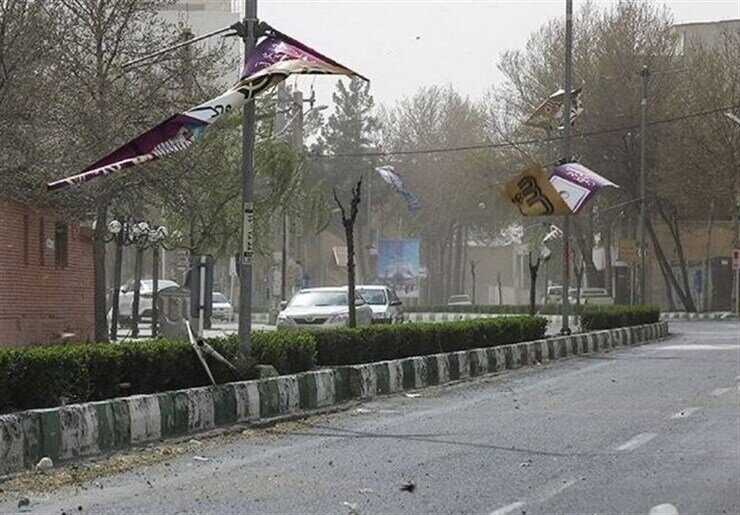
According to the warning, the first system will begin on Sunday, May 9, and will continue until Wednesday, May 9. During this time, in some hours, severe winds are expected to occur, especially in the afternoon and night hours. The area of this system will be mostly the southern and west of Tehran province.
As a result, there is a possibility of collapse of objects from altitude, damage to temporary structures such as scaffolds and boards, damage to high equipment such as rigs and towers, breaking trees, reducing air quality and horizontal vision, and expanding dust from neighboring provinces.
It is worth mentioning that the second system will be active from Sunday evening to late Monday, May 9, causing rain, thunderstorms, thunderstorms, and in some talented areas. The northern and west half of the province are affected by this system. Following the activity of this system, there is a possibility of slippery slippery, temporary road disruption, rising water levels, flooding of masses, and lightning.
Also, from Tuesday to Thursday morning, a significant decrease in temperature is projected to between 2 and 2 degrees Celsius, and in the high and mountainous areas, snow and blizzard is likely.
The Tehran Crisis Prevention and Management Organization warned citizens, advised to avoid traffic and stop along with loose structures and trees, to reinforce greenhouses and temporary equipment, and avoid mountaineering and hiking activities these days. Agricultural operators and executive agencies have also been emphasized to take the necessary measures to reduce potential damage.
(tagstotranslate) Tehran Meteorological Office (T) Tehran Wind (T) Tehran
Source:mehrnews